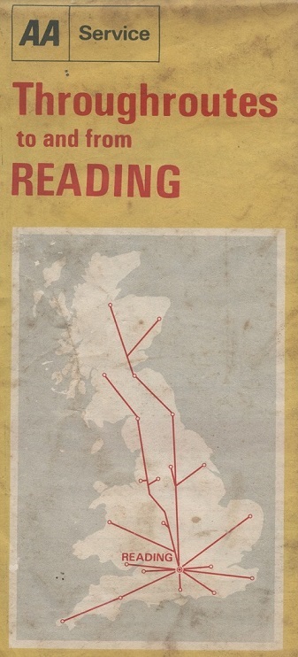
Another post in an occasional series – “Old maps found in charity shops“. This is an AA map, dated December 1970, that shows the driver how to get to Reading from any part of Great Britain.
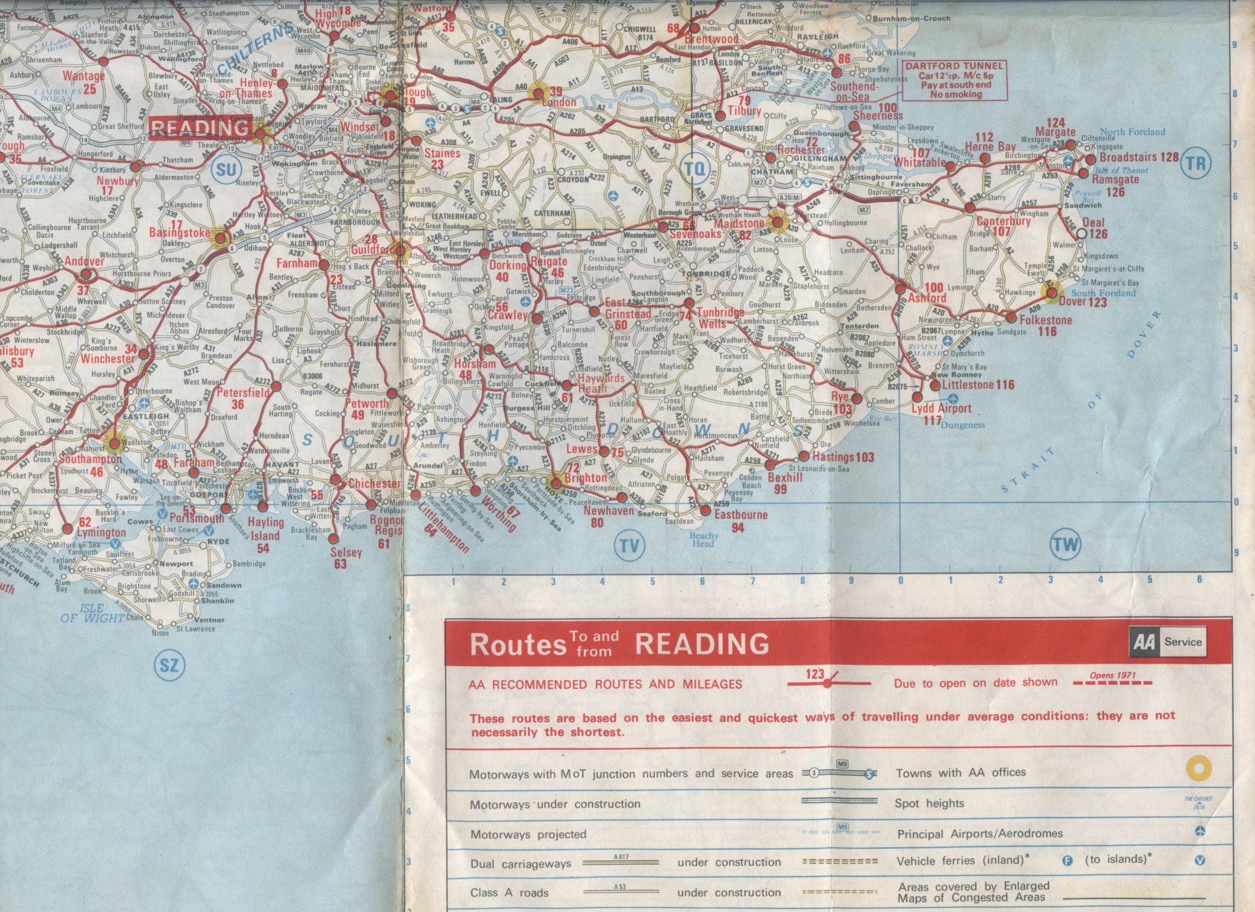
It’s a curiousity in that it is a highly specialised map, aimed at getting the driver to and from a single location, in this case, Reading. So to get from Brighton, say, to Reading, the journey is marked as 72 miles and the driver is directed via Horsham and Guilford (see the extract below, which only shows only the South East of England). Prior to computerised mapping it provided a useful way of determining how to get from A to B in the “easiest and quickest way… not necessarily the shortest”.
Introduced in 1968, the AA’s Throughroutes series covered 50 major towns.
The paper maps were supplanted by the online AA Route Planner, which shows a similar route from Brighton to Reading taking 79 miles.